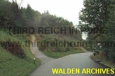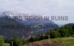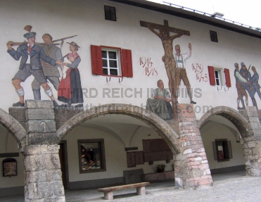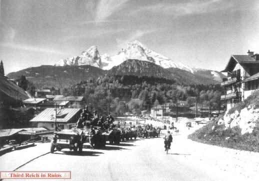
فكرت أكثر من مرة ، في ان أدون وأنشر صور عن مخبأ أدولف هتلر في جبال منطقة أوبرسالزبورج Obersalzberg في أعالي الجبال فوق بيرختيس جادن Berchtesgadenلا يمكن تصور جمال المنطقة ....
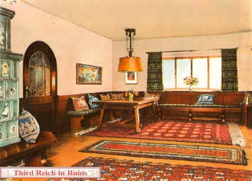
زرتها أكثر من مرة ... ومهما كتبت ... فلن يمكنني سوي القول ... بأنه يجب علي كل من يتمكن .. من زيارة هذه المنظقة ... وخاصة المخابيء المتحف الموجود هناك ....
وكما نعرف لا يكتب الألمان ولا ينشرون صور عن هذه المنطقة ... ويتناسون الماضي ...
وأخيرا وجدت صفحة أمريكية ... تمتليء بالصور والخرائط عن منزل هتلر ... ومخبأه ... والمخابيء في المنطقة ... ومنازل المارشال هيرمان جورنج ... وصور نادرة جدا ... بل عن المخابيء التي زرتهم في المنطفة
لذلك ... سأنشر السلسلة من الصور ...ومعهم بعض المعلومات باللغة الأنجليزية .... عن الأماكن التالية التي ترونها أيضا في الصورة الكبري
وفي نهاية السلسلة ... سأضع شرح كامل ... عن الأهالي في بيرختيس جادن Berchtesgaden ومشاعرهم تجاه الماضي والحاضر والأجانب علاوة علي بعض التصائح لمن يزور المنطقة
د. يحي الشاعر
اقتباس:
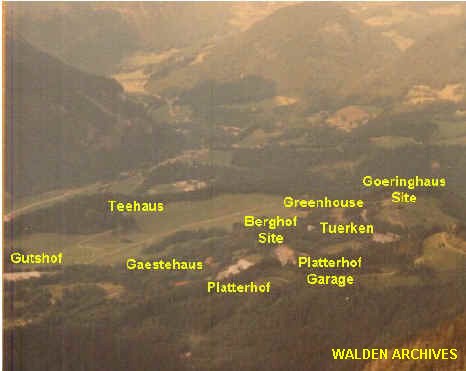
1 - Gِring's Adjutant's house6 - SS Kaserne11 - Platterhof2 - Gِring's house7 - Kindergarten/Modellhaus12 - Gنstehaus3 - Gِringhügl hill8 - Hotel Zum Türken13 - Main SS guardhouse4 - Greenhouse9 - Hitler's Berghof14 - Kampfhنusl5 - Bormann's house10 - Platterhof garage15 - Gutshof
زرتها أكثر من مرة ... ومهما كتبت ... فلن يمكنني سوي القول ... بأنه يجب علي كل من يتمكن .. من زيارة هذه المنظقة ... وخاصة المخابيء المتحف الموجود هناك ....
وكما نعرف لا يكتب الألمان ولا ينشرون صور عن هذه المنطقة ... ويتناسون الماضي ...
وأخيرا وجدت صفحة أمريكية ... تمتليء بالصور والخرائط عن منزل هتلر ... ومخبأه ... والمخابيء في المنطقة ... ومنازل المارشال هيرمان جورنج ... وصور نادرة جدا ... بل عن المخابيء التي زرتهم في المنطفة
لذلك ... سأنشر السلسلة من الصور ...ومعهم بعض المعلومات باللغة الأنجليزية .... عن الأماكن التالية التي ترونها أيضا في الصورة الكبري
1 - Goering's Adjutant's house6 - SS Kaserne11 - Platterhof2 - Gِoering's house7 - Kindergarten/Modellhaus12 - Gنstehaus3 - Gِoeringhügl hill8 - Hotel Zum Tuerken13 - Main SS guardhouse4 - Greenhouse9 - Hitler's Berghof14 - Kampfhنusl5 - Bormann's house10 - Platterhof garage15 - Gutshof
وفي نهاية السلسلة ... سأضع شرح كامل ... عن الأهالي في بيرختيس جادن Berchtesgaden ومشاعرهم تجاه الماضي والحاضر والأجانب علاوة علي بعض التصائح لمن يزور المنطقة
د. يحي الشاعر
اقتباس:
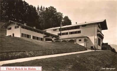
Obersalzberg Nazi Complex
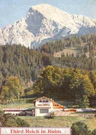
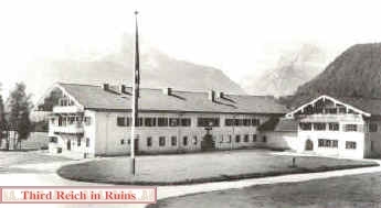
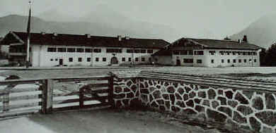
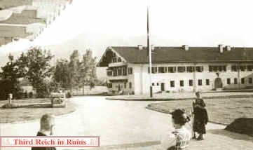
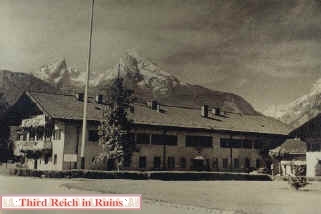
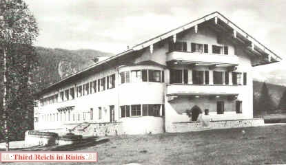
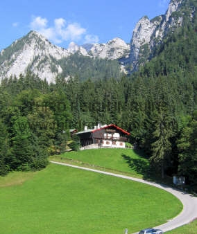
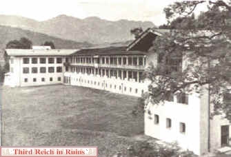
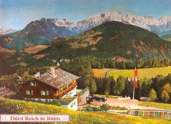
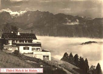
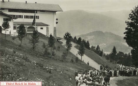
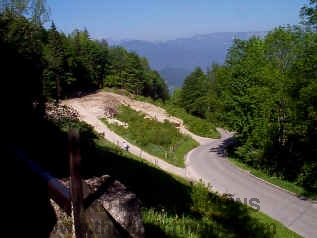
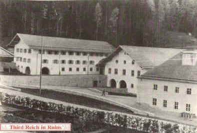
The main area of Nazi occupation in Berchtesgaden was on the Obersalzberg, a quiet mountain retreat two miles east of Berchtesgaden and some 1200 feet higher in elevation. This page is divided into various sections to cover this area; follow these links to visit each specific area: Berghof (Hitler's home), Bormann's and Gِring's houses, Platterhof, Gنstehaus and Kampfhنusl, Hotel Zum Türken, bunker system, Kehlsteinhaus (Eagles Nest), SS barracks, Gutshof and Teehaus, miscellaneous buildings.
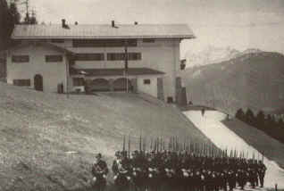
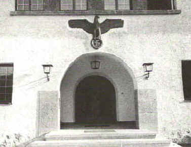
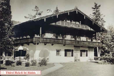
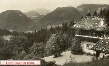
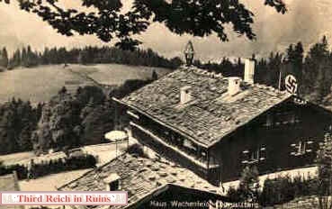
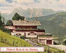
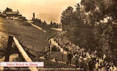
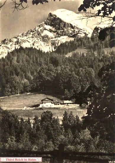
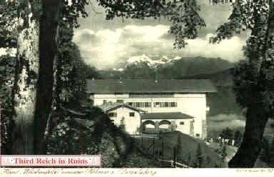
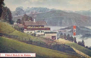
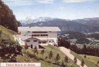
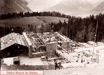
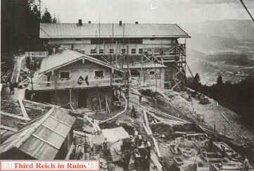
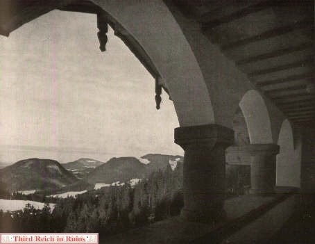
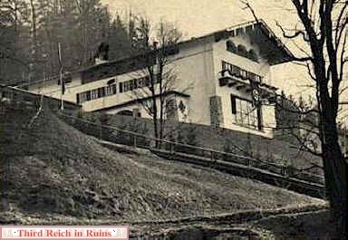
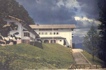
Construction of the eventual mammoth Nazi complex on the Obersalzberg began about 1935. Hitler already had his Haus Wachenfeld (later renamed the "Berghof"), and Hermann Gِring also had a small rustic house higher on the hill. Both of these were later enlarged and remodeled, although Gِring's house retained somewhat the character of a rustic country "landhaus" (Gِring was an avid hunter and outdoorsman). To control the crowds who came to see their Führer and Reichskanzler in his home in Berchtesgaden, SS guards were brought in, barracks had to be built, lodgings for all the workers needed for the construction and remodeling were required, accommodations for important guests were necessary, housing for all the needed staff had to be built, kindergartens for their children, etc. Soon the mountain area was a vast scene of construction, and a high fence was built around the entire area to keep the crowds away. Eventually, mostly by design of Nazi Reichsleiter Martin Bormann (who ran the Obersalzberg complex), Hitler's palatial Berghof (no longer a rustic mountain lodge) was surrounded by a security area from which the common people of the Third Reich were excluded. Some of these buildings can be seen in this 1981 photo, taken from the Kehlsteinhaus almost 3000 feet higher on the Hoher Gِll mountain overlooking the Obersalzberg. A plan showing these buildings appears below. Click here for a MapQuest map of the Obersalzberg.
Construction of the eventual mammoth Nazi complex on the Obersalzberg began about 1935. Hitler already had his Haus Wachenfeld (later renamed the "Berghof"), and Hermann Gِring also had a small rustic house higher on the hill. Both of these were later enlarged and remodeled, although Gِring's house retained somewhat the character of a rustic country "landhaus" (Gِring was an avid hunter and outdoorsman). To control the crowds who came to see their Führer and Reichskanzler in his home in Berchtesgaden, SS guards were brought in, barracks had to be built, lodgings for all the workers needed for the construction and remodeling were required, accommodations for important guests were necessary, housing for all the needed staff had to be built, kindergartens for their children, etc. Soon the mountain area was a vast scene of construction, and a high fence was built around the entire area to keep the crowds away. Eventually, mostly by design of Nazi Reichsleiter Martin Bormann (who ran the Obersalzberg complex), Hitler's palatial Berghof (no longer a rustic mountain lodge) was surrounded by a security area from which the common people of the Third Reich were excluded. Some of these buildings can be seen in this 1981 photo, taken from the Kehlsteinhaus almost 3000 feet higher on the Hoher Gِll mountain overlooking the Obersalzberg. A plan showing these buildings appears below. Click here for a MapQuest map of the Obersalzberg.
.
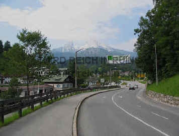
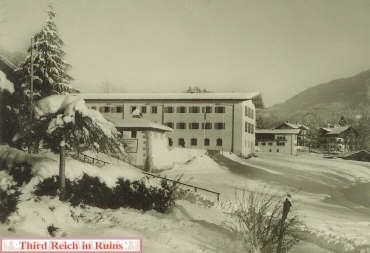
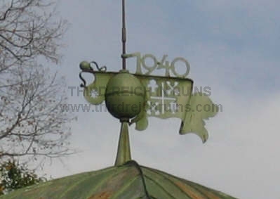
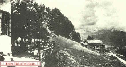
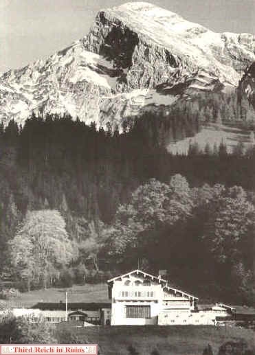
Compare this photo taken from the same spot ca. 1940. Most of the Obersalzberg buildings can be seen, although the Berghof is hidden behind the woods in the right-center of the photo.
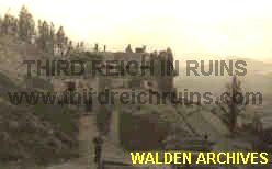
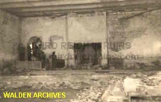
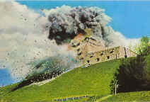
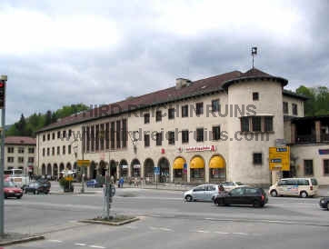
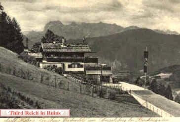
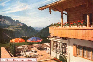
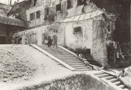
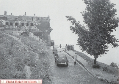
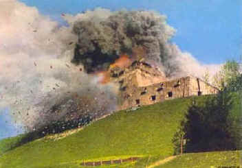
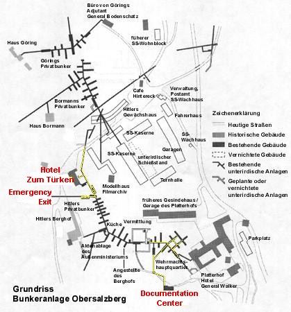
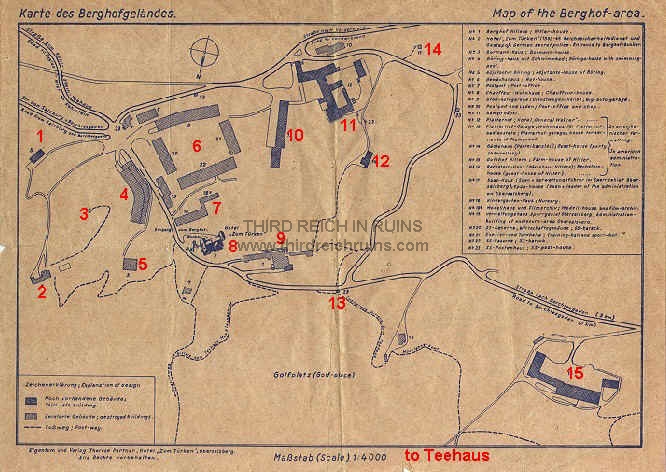
Many of these buildings were severely damaged and substantially destroyed in a Royal Air Force bombing attack on 25 April 1945. The map below shows the locations of the various buildings and ruins ca. 1960. (Verlag Therese Partner, Hotel Zum Türken (author's collection)
Many of these buildings were severely damaged and substantially destroyed in a Royal Air Force bombing attack on 25 April 1945. The map below shows the locations of the various buildings and ruins ca. 1960. (Verlag Therese Partner, Hotel Zum Türken (author's collection)
1 - Gِring's Adjutant's house6 - SS Kaserne11 - Platterhof2 - Gِring's house7 - Kindergarten/Modellhaus12 - Gنstehaus3 - Gِringhügl hill8 - Hotel Zum Türken13 - Main SS guardhouse4 - Greenhouse9 - Hitler's Berghof14 - Kampfhنusl5 - Bormann's house10 - Platterhof garage15 - Gutshof
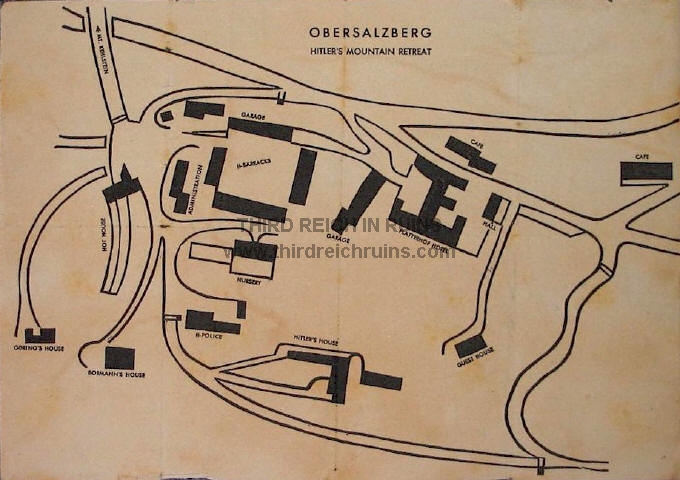
This interesting plan of the central Obersalzberg area can be compared to the one above. This plan was published
ca. 1945, apparently for use of the first U.S. soldiers who reached the area. It was apparently published prior to the
American occupation of the Obersalzberg, as it contains several errors that probably would not have been made by
a mapmaker who was on the ground. (author's cllection)
ca. 1945, apparently for use of the first U.S. soldiers who reached the area. It was apparently published prior to the
American occupation of the Obersalzberg, as it contains several errors that probably would not have been made by
a mapmaker who was on the ground. (author's cllection)
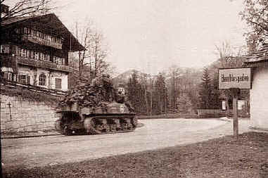
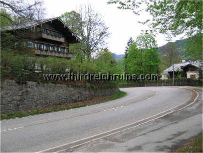
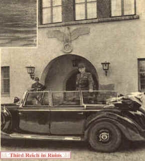
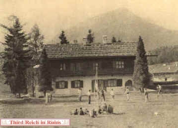
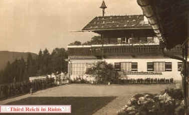
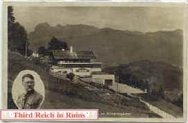
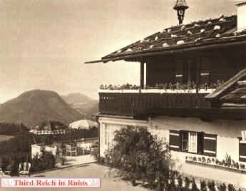
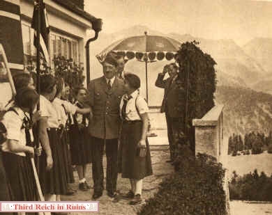
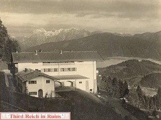
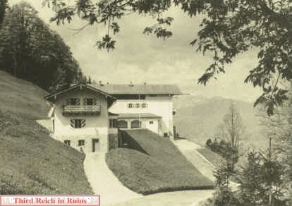
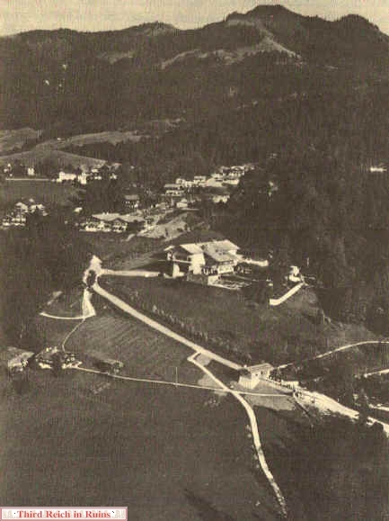
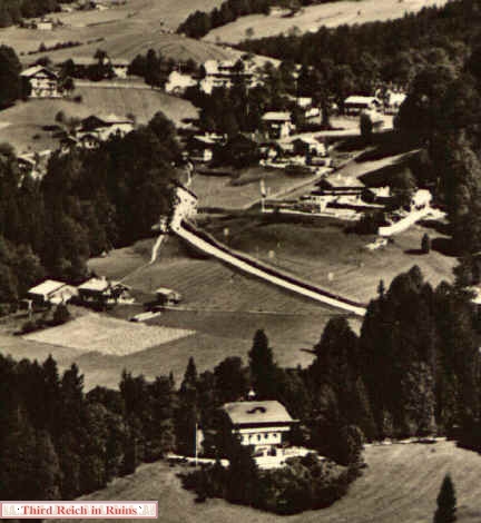
This interesting aerial photo shows the core Obersalzberg area in the summer of 1936, following the conversion of Hitler's Haus Wachenfeld into the Berghof. The view is looking southeast, with the Berghof in the center. On the road below the Berghof can be seen the main SS guard house, which spanned the access road. The road going down the hill below the guard house led to Villa Bechstein, which the Nazis used as a guest house for visiting dignitaries, most usually Josef Goebbels.
At the same level as the guard house, on the left side of this view, is Freidinglehen, the Rasp house. The elderly farmer Josef "Fleck" Rasp was Hitler's closest neighbor, but he was forced to sell out and move away soon after this picture was taken, since Martin Bormann would not allow private individuals to live in the closed-off Führer area. Just above the Rasp house can be seen the beginning of the walkway to Hitler's Teehaus on the Mooslahnerkopf.
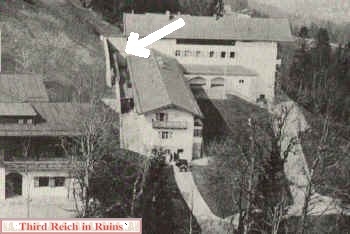
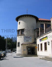
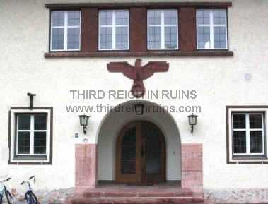
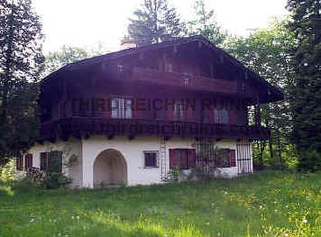
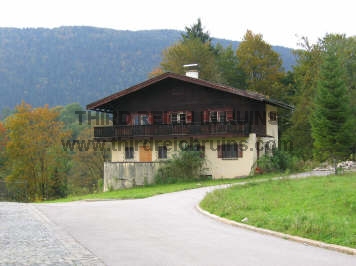
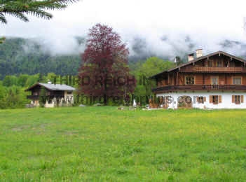
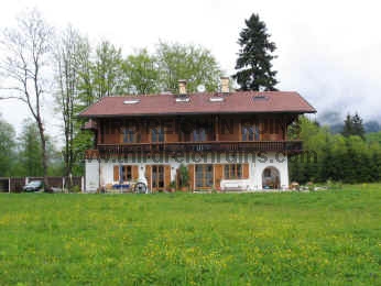
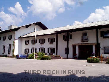
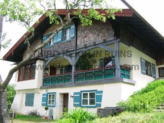
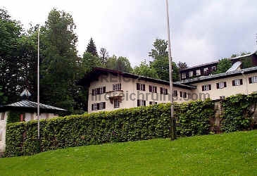
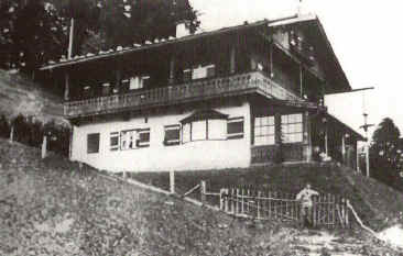
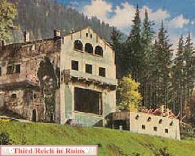
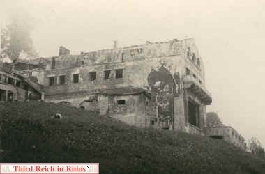
To the left-rear of the Berghof can be seen the Hotel Zum Türken, whose proprietor had already been forced to leave by the Nazis, and the building was being used by the SS guard force. Up the hill behind the Türken can be seen various private houses, which were all later torn down by Bormann to make room for the SS barracks complex.
Just to the left of the Türken is the Oberwurflehen house, which also fell victim to Bormann's plans. On the hill above, between Oberwurflehen and the Türken, is the Obersalzberg chapel "Maria Hilf," which would also shortly be torn down by Bormann.
(National Archives, RG 260-NS)
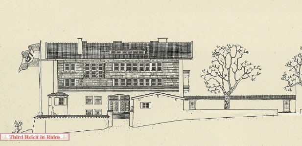
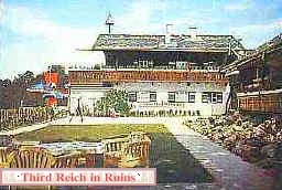
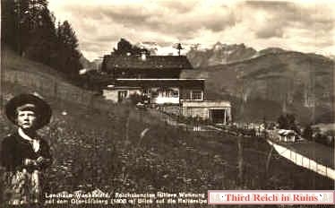
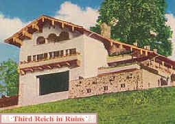
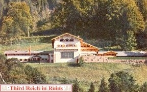
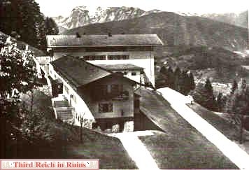
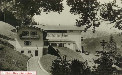
Compare the top view to the ca.1934 view at left, showing Haus Wachenfeld after its first renovation, and to the May 1945 photo below. In the earlier view at left, the building at the bottom is the rarely-seen Villa Bechstein, owned by Helena Bechstein of the world famous piano making family. She was an ardent Hitler supporter, and Bormann had the use of her Obersalzberg villa as a guesthouse. When Goebbels visited Hitler on the Obersalzberg, he usually stayed in the Villa Bechstein.
(1942-dated postcard in author's collection)
At the same level as the guard house, on the left side of this view, is Freidinglehen, the Rasp house. The elderly farmer Josef "Fleck" Rasp was Hitler's closest neighbor, but he was forced to sell out and move away soon after this picture was taken, since Martin Bormann would not allow private individuals to live in the closed-off Führer area. Just above the Rasp house can be seen the beginning of the walkway to Hitler's Teehaus on the Mooslahnerkopf.
To the left-rear of the Berghof can be seen the Hotel Zum Türken, whose proprietor had already been forced to leave by the Nazis, and the building was being used by the SS guard force. Up the hill behind the Türken can be seen various private houses, which were all later torn down by Bormann to make room for the SS barracks complex.
Just to the left of the Türken is the Oberwurflehen house, which also fell victim to Bormann's plans. On the hill above, between Oberwurflehen and the Türken, is the Obersalzberg chapel "Maria Hilf," which would also shortly be torn down by Bormann.
(National Archives, RG 260-NS)
Compare the top view to the ca.1934 view at left, showing Haus Wachenfeld after its first renovation, and to the May 1945 photo below. In the earlier view at left, the building at the bottom is the rarely-seen Villa Bechstein, owned by Helena Bechstein of the world famous piano making family. She was an ardent Hitler supporter, and Bormann had the use of her Obersalzberg villa as a guesthouse. When Goebbels visited Hitler on the Obersalzberg, he usually stayed in the Villa Bechstein.
(1942-dated postcard in author's collection)
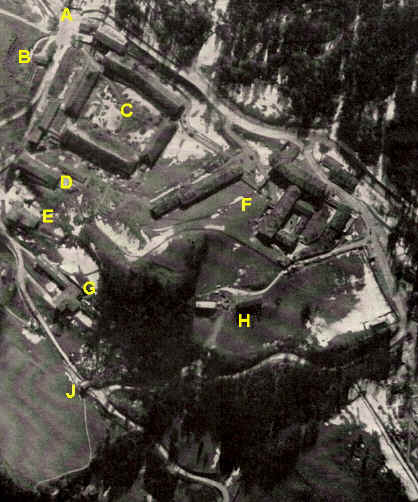
This aerial reconnaissance photo was taken prior to the 25 April 1945 bombing of the Obersalzberg, for pilots and bombardiers to study. Some snow shows on the ground in this March 1945 photo, but the dark mottling that can be seen on the roofs of several of the buildings was camouflage netting or an attempt at camouflage painting. Some of the buildings also received camouflage patterns on their sides late in the war. Obviously, this was a futile effort. Key to the identifications:
A -- Hintereck area
B -- Greenhouse building
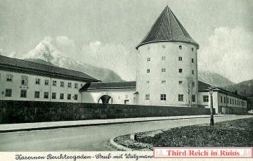
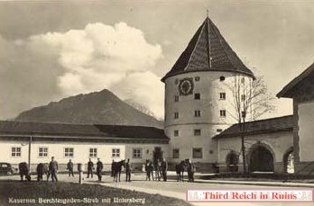
C -- SS Kaserne
D -- Kindergarten and Modellhaus/Filmarchiv
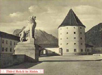
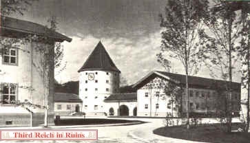
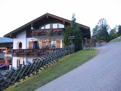
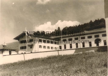
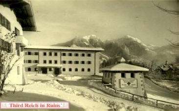
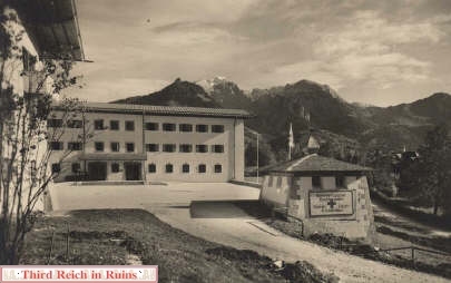
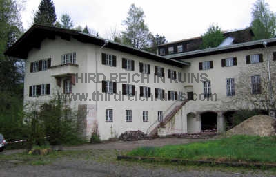
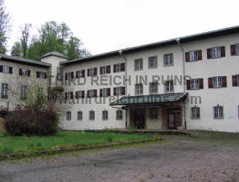
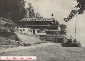
E -- Hotel Zum Türken
F -- Platterhof complex
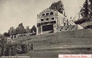
G -- Hitler's Berghof
H -- Gنstehaus Hoher Gِll
J -- SS guard house
(U.S. Army photo, Life Magazine, 19 March 1945)
A -- Hintereck area
B -- Greenhouse building
C -- SS Kaserne
D -- Kindergarten and Modellhaus/Filmarchiv
E -- Hotel Zum Türken
F -- Platterhof complex
G -- Hitler's Berghof
H -- Gنstehaus Hoher Gِll
J -- SS guard house
(U.S. Army photo, Life Magazine, 19 March 1945)
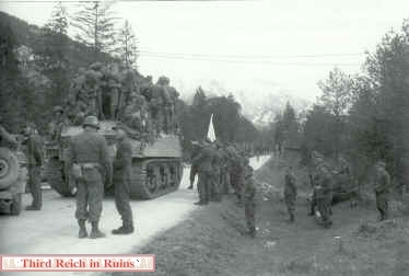
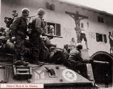
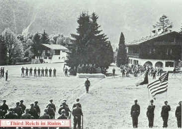
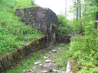
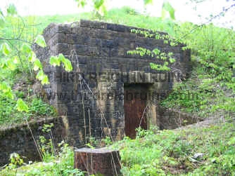
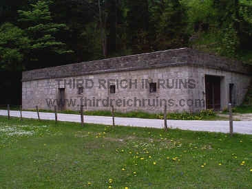
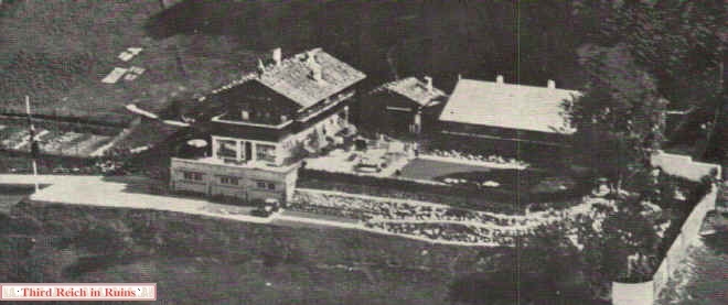
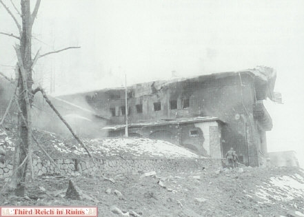
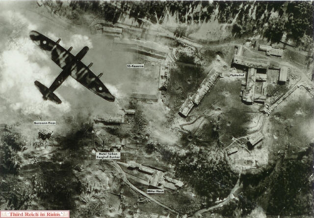
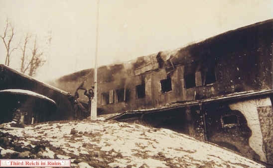
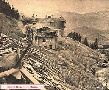
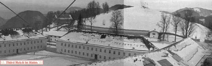
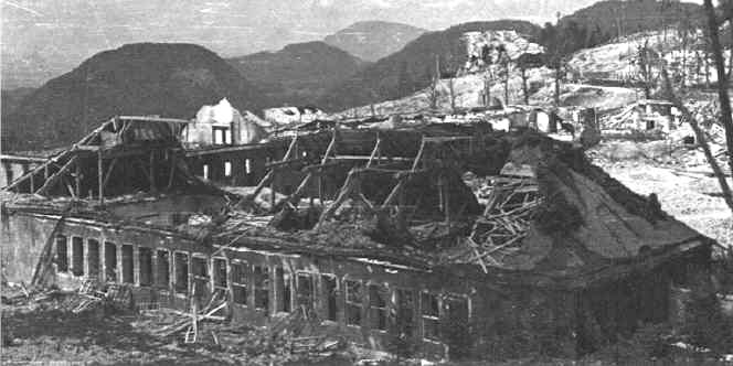
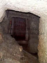
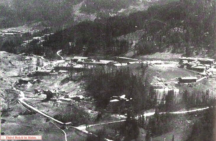
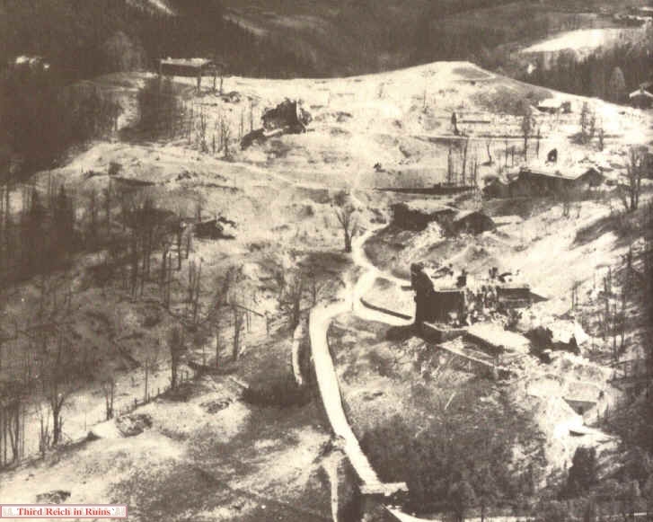
This photo, one of a series of aerial views taken in mid-May 1945 by the U.S. Army Air Forces, shows a similar view to that above (showing more to the right). The ruined Berghof, hit at least twice during the 25 April 1945 bombing by the RAF, and later set on fire by departing SS troops, is at the lower left-center of the photo. Comparing to the photo and map above, you can also see the partly-ruined Hotel Zum Türken and the main SS guard house. Uphill from the Türken is the bombed-out SS barracks complex. Not visible in the photo above, but seen in this one, are the Platterhof hotel (right center), with its Guest House just below. The roof of the garage and employees quarters for the Platterhof can be seen to the left of the Platterhof, adjacent to the SS barracks. This view also shows one of the emergency exits to the air raid shelter system beneath the hill behind the Berghof - a lighter hued area just off the left wingtip of the P-47 Thunderbolt seen in the lower center of the photo. In the left distance can be seen the buildings of the Klaushِhe settlement. (National Archives, RG 342-FH)
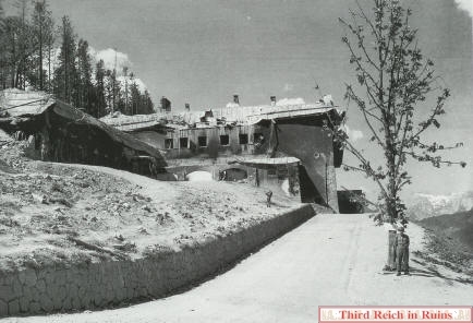
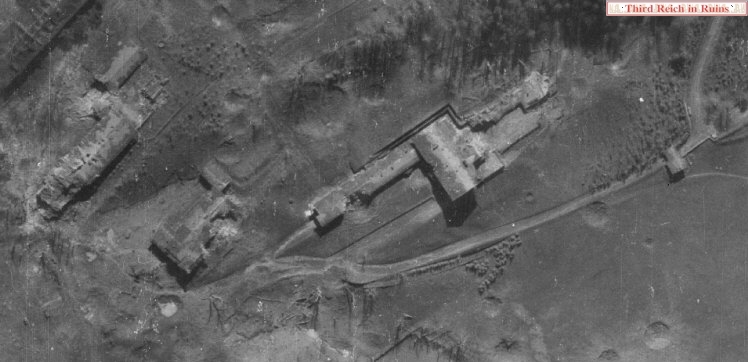
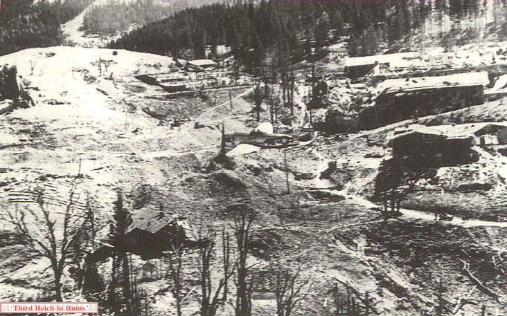
Another in the series of May 1945 aerial views shows the Hotel Zum Türken on the right, with the ruins of the Kindergarten house and the SS barracks uphill behind it. To the left of the SS barracks buildings is the shattered greenhouse, and farther on, at the left edge of this view, are the ruins of Bormann's house. In the lower left-center of the photo is the bombed Unterwurflehen house, where the SS officer who ran the Obersalzberg administrative offices lived. Note how the bombing churned the roads up so that they were barely passable in this area, and note the P-47 Thunderbolt in the center of the photo. (National Archives, RG 342-FH, 3A20805)
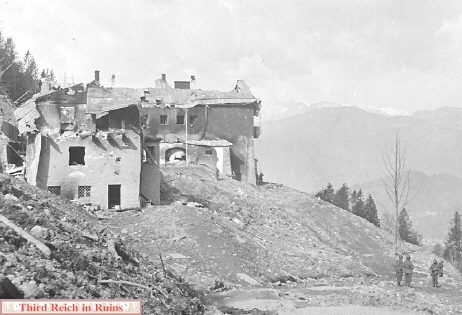
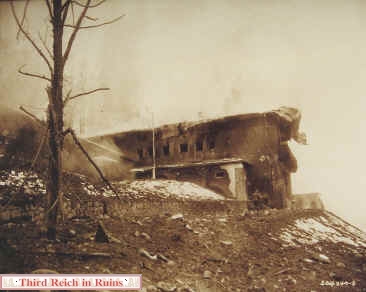
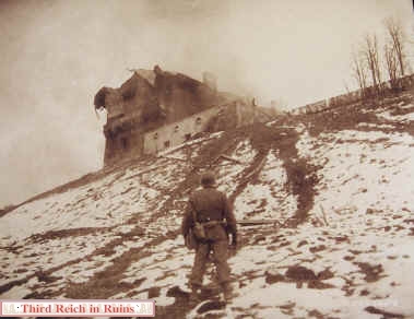
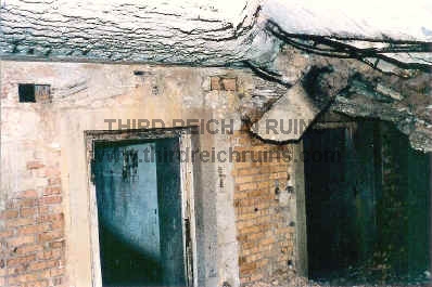
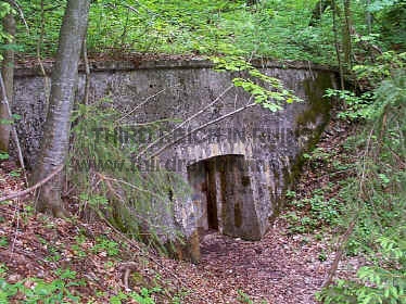
A part of another in the series of May 1945 aerial views shows this same area, from a different angle. The main SS guardhouse is at the bottom, with the Berghof ruins in the right-center of the photo and the Türken just above. In the left-center are the ruins of the Unterwurflehen house, with Bormann's destroyed house on the hill above. Landhaus Gِring appears at the upper left (looking not too badly damaged here). This photo has a good view of one of the Berghof bunker emergency exits, to the lower right of the Berghof ruins (see a modern photo of this bunker exit here). Many of the bomb craters seen in these 1945 photos can still be found in undeveloped areas on the Obersalzberg. (National Archives, RG 342-FH)
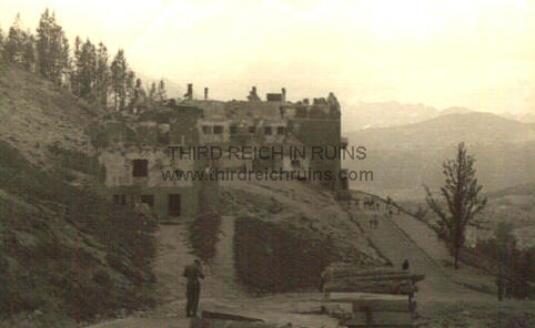
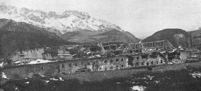
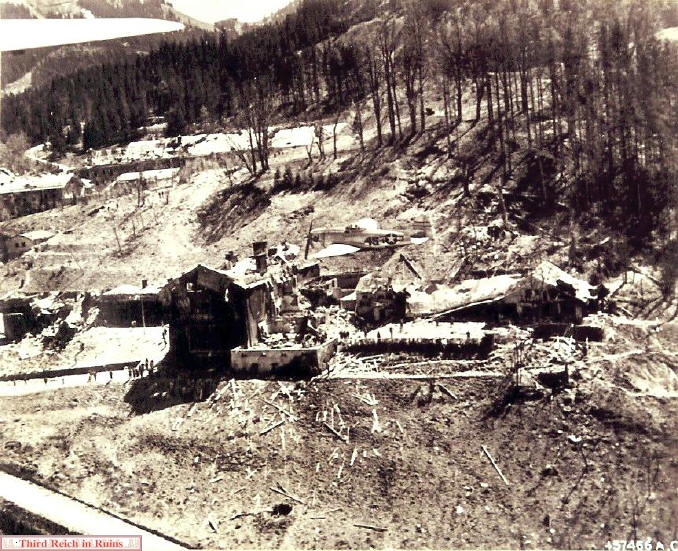
In this view the P-47 Thunderbolt is flying in front of the ruins of Hitler's Berghof. The destruction from the bombing
and fire is evident. Buildings of the SS Kaserne can be seen in the left background. (National Archives, RG 342-FH, 3A20796)
and fire is evident. Buildings of the SS Kaserne can be seen in the left background. (National Archives, RG 342-FH, 3A20796)
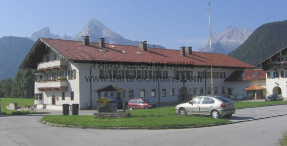
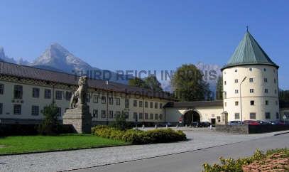
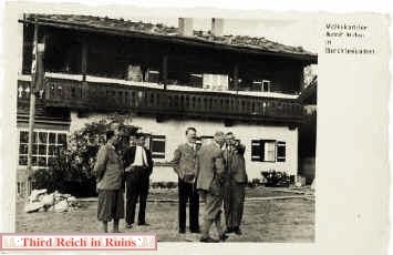
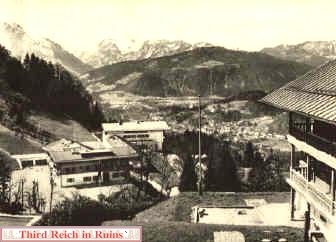
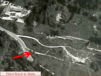
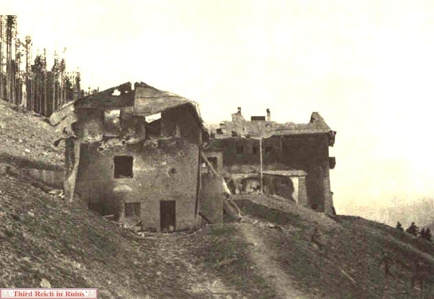
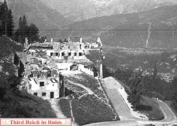
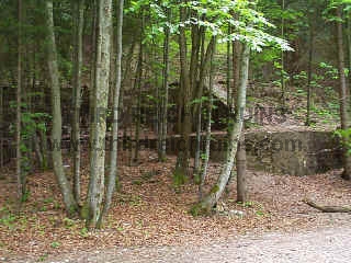
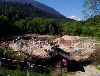
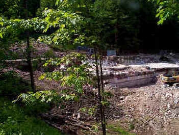
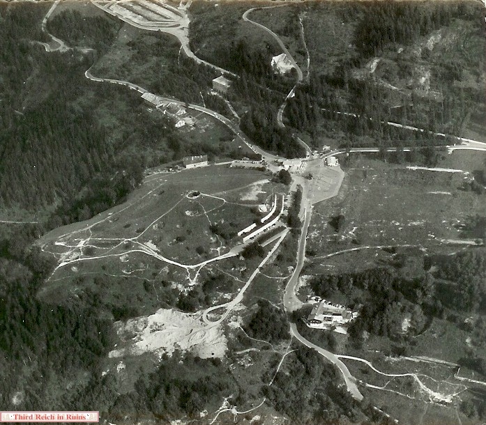
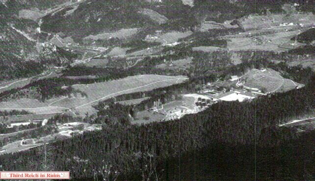
This photo taken about 1960 shows the ruins of the Obersalzberg. Comparison to the photos and map above will identify most of these features. The Berghof site is at the lower-right - the garage and retaining walls can be seen. The rebuilt Hotel Zum Türken is adjacent, with an open area above, where the SS Kaserne was located. The large dug out area across the road from the Türken (below the site of Bormann's house) was where fill was taken to make the parking lot for the Kehlsteinhaus buses, which can be seen near the center of the photo (contrary to some sources, this fill was not taken from the actual site of Bormann's house, but from further down the hill). The greenhouse foundations can be seen in the center of the photo, with the Gِring Hill to the left, still showing numerous bomb craters. Above that can be seen Gِring's Adjutant's house, the SS houses at the Hintereck, the Koksbunker, and at the top of the photo, the parking lot for the Klaushِhe settlement.